Outline: The Importance of Using Maps in the Classroom
| Main Heading |
Subheadings |
| 1. Introduction |
1.1 Definition of Geography Education |
| |
1.2 Overview of the Role of Maps in Learning |
| 2. Historical Importance of Maps in Education |
2.1 Evolution of Maps as Educational Tools |
| |
2.2 Early Use of Maps in Classrooms |
| 3. Maps as Visual Learning Tools |
3.1 Enhancing Spatial Awareness |
| |
3.2 Facilitating Memory Retention |
| 4. Types of Maps and Their Educational Benefits |
4.1 Physical Maps |
| |
4.2 Political Maps |
| |
4.3 Thematic Maps |
| |
4.4 Interactive Digital Maps |
| 5. Integrating Maps into Geography Curriculum |
5.1 Designing Lessons Around Maps |
| |
5.2 Map-based Activities and Projects |
| |
5.3 Cross-disciplinary Connections |
| 6. Case Studies: Success Stories from Classrooms |
6.1 School A: Increasing Engagement with Digital Maps |
| |
6.2 School B: Hands-on Learning with Thematic Maps |
| 7. Overcoming Challenges in Using Maps |
7.1 Access to Quality Maps |
| |
7.2 Adapting to Different Learning Styles |
| |
7.3 Budget Constraints |
| 8. The Future of Maps in Education |
8.1 Emerging Technologies in Mapping |
| |
8.2 The Role of Augmented Reality in Geography |
| 9. Practical Tips for Educators |
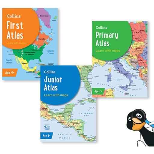
9.1 Choosing the Right Maps for Your Class |
| |
9.2 Encouraging Critical Thinking Through Maps |
| |
9.3 Utilizing Online Resources and Tools |
| 10. Conclusion |
10.1 Summary of Key Points |
| |
10.2 Final Thoughts and Call to Action |
Teaching Geography: The Importance of Using Maps in the Classroom
1. Introduction
1.1 Definition of Geography Education
Geography education involves more than just the study of locations on a map. It is the exploration of the Earth’s landscapes, environments, and the relationships between people and their environments. This field encompasses various scales, from local communities to global ecosystems, and integrates aspects of physical and human geography.
1.2 Overview of the Role of Maps in Learning
Maps are vital tools in geography education, serving as visual representations that help students understand spatial relationships, patterns, and processes. Whether it’s understanding the distribution of natural resources, the impact of human activities on the environment, or the cultural differences between regions, maps provide a tangible way to connect abstract concepts to real-world locations.
2. Historical Importance of Maps in Education
2.1 Evolution of Maps as Educational Tools
Maps have been used as educational tools for centuries, evolving from simple, hand-drawn representations of local areas to sophisticated, digitally rendered global projections. Early maps were often rudimentary, focusing on major landforms and bodies of water. Over time, as cartography advanced, maps became more detailed and accurate, making them indispensable tools in education.
2.2 Early Use of Maps in Classrooms
The use of maps in classrooms dates back to the 16th and 17th centuries when they were introduced as part of the broader curriculum in European schools. These early maps helped students develop a sense of the world beyond their immediate surroundings, fostering a global perspective that was essential for understanding the era’s rapidly expanding geographical knowledge.
3. Maps as Visual Learning Tools
3.1 Enhancing Spatial Awareness
Maps are unparalleled in their ability to enhance spatial awareness. They allow students to see the world from a bird’s-eye view, understanding the relative positions of places, distances, and the spatial distribution of various features. This spatial awareness is crucial for developing geographic literacy, which is essential for navigating both physical and social spaces.
3.2 Facilitating Memory Retention
Visual learning is a powerful tool for memory retention, and maps, with their combination of images, symbols, and labels, help students retain information more effectively. Studies have shown that students who learn through visual aids, such as maps, often perform better in recalling information and applying it to different contexts, compared to those who rely solely on text-based learning.
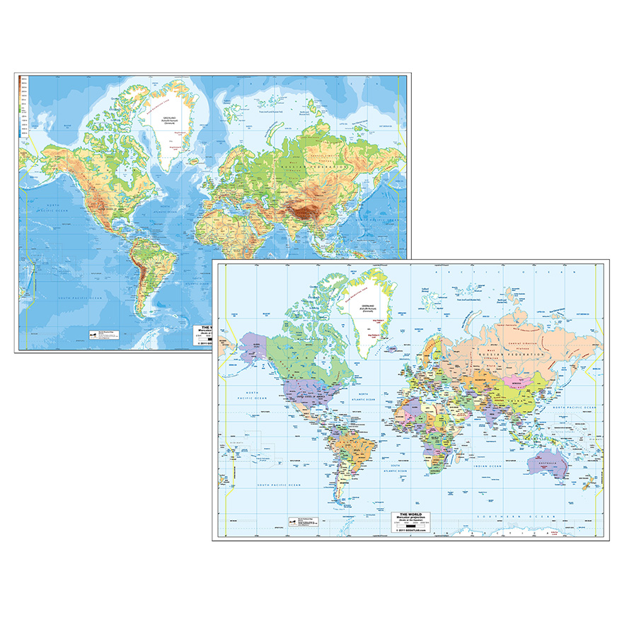
4. Types of Maps and Their Educational Benefits
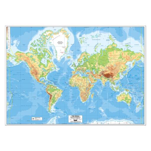
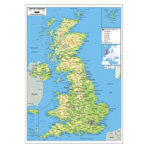
4.1 Physical Maps
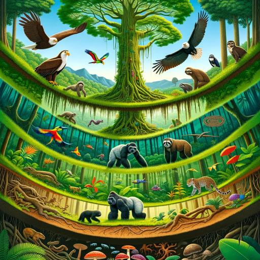
Physical maps depict the physical features of the Earth, such as mountains, rivers, and deserts. These maps are essential for teaching students about the natural world, helping them understand the Earth's topography and the distribution of natural resources. By studying physical maps, students can grasp how geography influences climate, vegetation, and human settlement patterns.
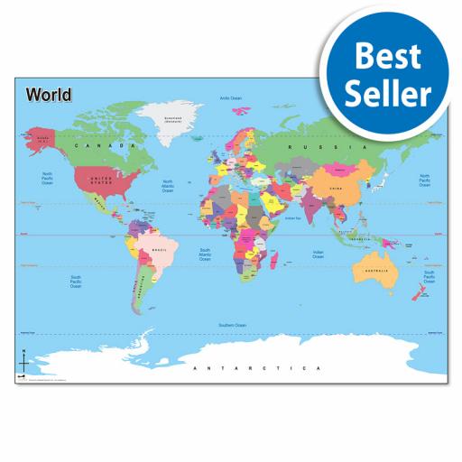
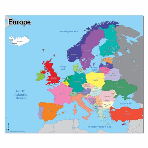
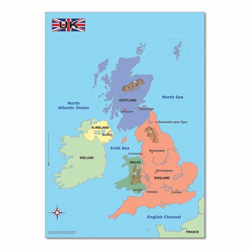
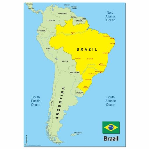
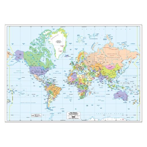
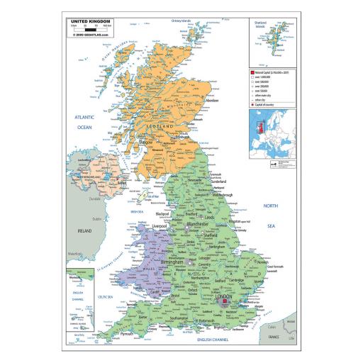
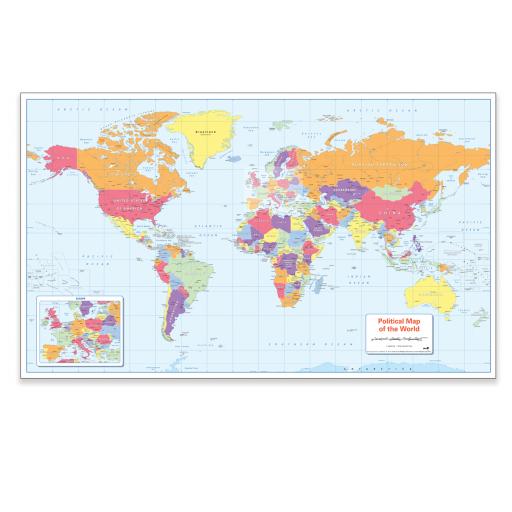
4.2 Political Maps
Political maps, which show the boundaries of countries, states, and cities, are crucial for teaching students about human geography. These maps help students understand the political landscape of the world, including the distribution of populations, cultural regions, and the impact of political boundaries on social and economic activities.
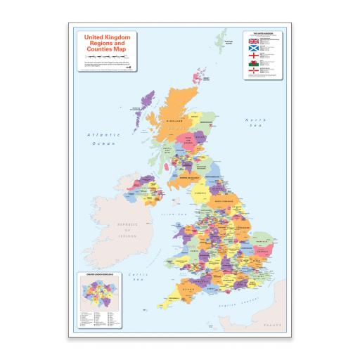
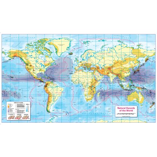
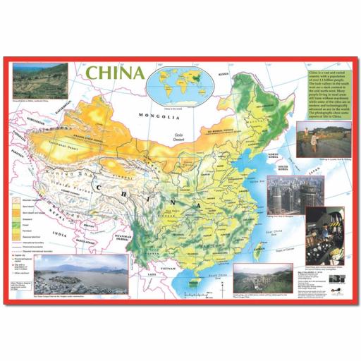
4.3 Thematic Maps
Thematic maps focus on specific themes or subjects, such as population density, climate zones, or economic activities. These maps are particularly useful for teaching about the relationships between different geographic factors. For example, a thematic map showing rainfall patterns can help students understand the connection between climate and agricultural practices in different regions.
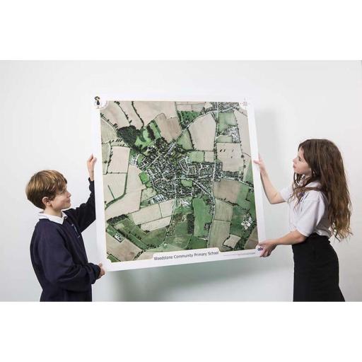
4.4 Interactive Digital Maps
Interactive digital maps have revolutionized geography education by offering dynamic, user-friendly platforms for exploring geographic data. These maps allow students to zoom in and out, switch between different layers of information, and engage with real-time data. Digital maps also often include tools for measuring distances, comparing regions, and conducting spatial analysis, making them invaluable in modern classrooms.
5. Integrating Maps into Geography Curriculum
5.1 Designing Lessons Around Maps
To effectively integrate maps into geography education, lessons should be designed with maps at their core. This means using maps not just as supplementary materials but as central elements of instruction. For example, a lesson on climate change can begin with students examining a map of global temperature changes over time, followed by a discussion on the factors contributing to these changes.
5.2 Map-based Activities and Projects
Map-based activities, such as creating custom maps, conducting geographic surveys, or engaging in map-based simulations, can greatly enhance student engagement. Projects like tracing the historical migration patterns of a population or mapping out local resources help students apply their knowledge in practical, hands-on ways, fostering deeper understanding and retention.
5.3 Cross-disciplinary Connections
Maps also provide opportunities for cross-disciplinary connections, linking geography with subjects like history, science, and art. For instance, in history classes, maps can be used to trace the territorial changes of empires, while in science, they can help students understand the distribution of different ecosystems. These interdisciplinary approaches enrich the learning experience and make geography more relevant to students’ lives.
6. Case Studies: Success Stories from Classrooms
6.1 School A: Increasing Engagement with Digital Maps
In School A, the introduction of interactive digital maps transformed the way students engaged with geography. By using platforms like Google Earth and ArcGIS, students were able to explore distant places virtually, analyze geographic data, and even contribute to community mapping projects. This hands-on approach not only increased engagement but also improved students' spatial thinking skills.
6.2 School B: Hands-on Learning with Thematic Maps
At School B, thematic maps became a central part of the curriculum, especially in teaching about environmental issues. Students created maps showing local pollution levels, which they then presented to the community as part of an environmental awareness campaign. This project not only taught students about the impact of pollution but also empowered them to take action in their own community.
7. Overcoming Challenges in Using Maps
7.1 Access to Quality Maps
One of the challenges educators face is access to high-quality, up-to-date maps. While digital resources have made maps more accessible, there are still barriers, such as the cost of software licenses or the need for reliable internet access. Schools can overcome these challenges by utilizing free online resources, partnering with local libraries, or collaborating with universities that may provide access to advanced mapping tools.
7.2 Adapting to Different Learning Styles
Not all students learn in the same way, and this is especially true when it comes to using maps. Some students may find it challenging to interpret complex maps or to engage with digital interfaces. To address this, teachers can provide a variety of maps, from simple physical maps to interactive digital ones, and offer guidance on how to read and analyze them effectively.
7.3 Budget Constraints
Budget constraints are a common issue in education, and they can limit the availability of high-quality maps. To mitigate this, educators can make use of free or low-cost resources, such as online map collections, open-source mapping tools, and printed maps available through educational grants or donations. Additionally, teachers can create their own maps using free tools like Google My Maps, ensuring that all students have access to the necessary resources.
8. The Future of Maps in Education
8.1 Emerging Technologies in Mapping
The future of geography education is closely tied to emerging technologies in mapping. Innovations such as 3D mapping, drone-based aerial surveys, and real-time data integration are expanding the possibilities for using maps in the classroom. These technologies allow students to interact with geographic data in ways that were previously unimaginable. For example, 3D maps can provide immersive experiences where students can explore different terrains as if they were there in person, enhancing their understanding of physical geography.
8.2 The Role of Augmented Reality in Geography
Augmented Reality (AR) is another technology poised to revolutionize geography education. With AR, students can overlay digital information onto the real world, providing a deeper understanding of geographic concepts. For instance, by pointing a tablet or smartphone at a physical map, students could see layers of information pop up, such as historical events, demographic data, or environmental changes. This interactive experience makes learning more engaging and helps to cement complex concepts in students' minds.
9. Practical Tips for Educators
9.1 Choosing the Right Maps for Your Class
Selecting the right maps for your geography lessons is crucial. Consider the age group, the learning objectives, and the students’ familiarity with maps. For younger students, start with simple physical or political maps, and gradually introduce more complex thematic and digital maps as they advance. Ensure that the maps are accurate, up-to-date, and relevant to the topics being covered.
9.2 Encouraging Critical Thinking Through Maps
Maps are not just tools for locating places; they are also powerful instruments for critical thinking. Encourage students to analyze maps critically by asking questions such as: What does this map show? What might be the reason for the patterns observed? How might different maps of the same area tell different stories? By fostering a questioning approach, students learn to think more deeply about the information presented to them.
9.3 Utilizing Online Resources and Tools
The internet offers a wealth of resources for incorporating maps into your teaching. Websites like National Geographic, Google Earth, and OpenStreetMap provide free access to a variety of maps and interactive tools. These resources can be used to create custom maps, explore different regions of the world, and conduct virtual field trips. Additionally, many educational websites offer lesson plans and activities centered around map use, helping you integrate them into your curriculum more effectively.
10. Conclusion
10.1 Summary of Key Points
Maps play a crucial role in geography education, helping students to develop spatial awareness, retain information, and engage with the world around them. Whether through traditional physical maps or modern digital and thematic maps, these tools make geography more accessible and interesting. By integrating maps into the curriculum, educators can enhance learning outcomes and foster a deeper understanding of the world.
10.2 Final Thoughts and Call to Action
As the world becomes increasingly interconnected, understanding geography is more important than ever. Maps provide a unique way to explore our planet and the complex systems that shape it. Educators are encouraged to embrace the diverse range of maps available today and to use them creatively in their classrooms. By doing so, they can inspire the next generation of global citizens who are curious, informed, and ready to engage with the world.